Somalia · World Bank
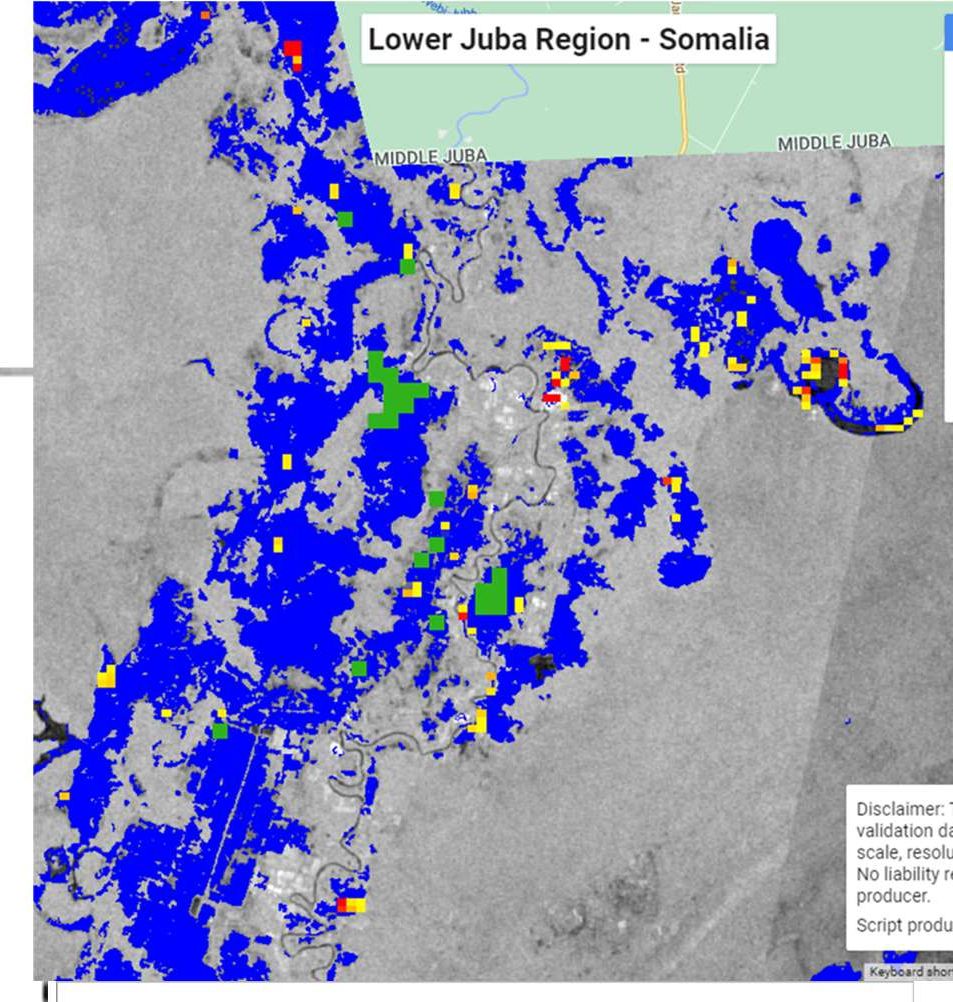
Flood risk mapping, Mogadishu
Satellite flood mapping of 17 districts, verified with engineers and communities, used to prioritise drainage investment.
Applied geospatial research for climate-resilient infrastructure and sustainable investment decisions.
Bensheim, Germany · +49 152 10737089 · aquilinawawiram@gmail.com · Available immediately
Over 15+ years I have applied GIS, satellite data and field surveys to climate resilience and infrastructure in 12+ countries. My flood mapping of all 17 districts of Mogadishu became the basis for prioritising drainage investments, and I screened about 100 solar mini-grid sites for Sierra Leone’s Ministry of Energy.
My MSc in Geographic Information Systems (University of Nairobi) used climate and geospatial data to project run-off in Nairobi County. My MBA thesis at Hochschule Darmstadt (submitted October 2026, results pending) developed geospatial ESG risk-scoring dashboards for renewable energy portfolios in Germany, aligned with CSRD/ESRS and LkSG.
Through my work evaluating AI models on surveying and GIS reasoning, I have seen how confidently these models can be wrong about space. This drives my interest in reliable, explainable GeoAI for decisions that matter.
Integrating Geospatial Intelligence, Artificial Intelligence and ESG Risk Assessment for Climate-Resilient Renewable Energy Infrastructure
A proposed direction, open to refinement with a supervisor.
How can satellite and GIS data measure climate hazards such as flood, heat and wind for renewable energy sites?
Can GeoAI models score site risk reliably, and how should their errors be measured?
How can spatial risk scores feed ESG reporting (CSRD/ESRS) and investment choices?
What dashboards help authorities and investors act on this evidence?
Satellite flood mapping of 17 districts, verified with engineers and communities, used to prioritise drainage investment.
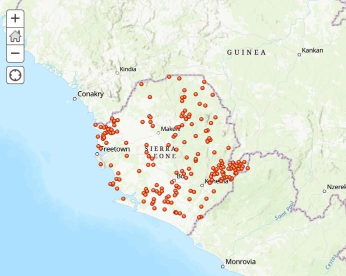
An ArcGIS platform comparing about 100 candidate sites, later extended with baseline, midline and endline survey data.
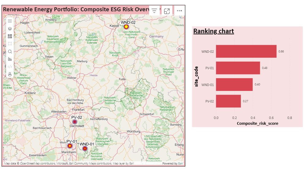
QGIS and Power BI dashboards scoring climate and ESG risk for renewable energy portfolios in Germany.
Contact details are shared on request.
Professor of Marketing; MBA Director
Hochschule Darmstadt · Germany
MBA thesis supervisorSenior Lecturer, Geospatial & Space Technology
University of Nairobi · Kenya
Academic referee (MSc GIS)Regional Director, Europe & Central Asia
UNOPS · Switzerland
Former line managerManaging Director
VIOLA HQMC GmbH · Germany
Current supervisorBensheim, Germany · available immediately
+49 152 10737089 · aquilinawawiram@gmail.com